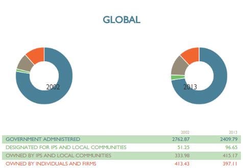
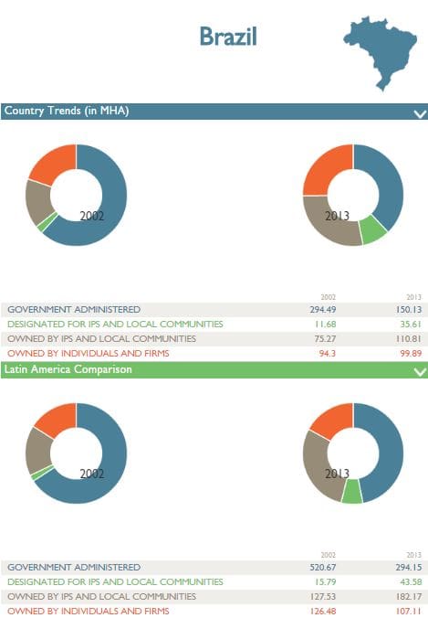
Who has legal ownership over the world’s forests? And how has that ownership changed over time? RRI’s new interactive Forest Tenure Tool lets you compare forest tenure trends globally, regionally, and in 52 countries.

This tool shows how many hectares of forest land were claimed by governments and private individuals, or titled to Indigenous Peoples and local communities, in 2002 and 2013. You can easily compare countries to other countries and countries to regions to see where the recognition of forest rights is advancing, and where it’s stagnating.

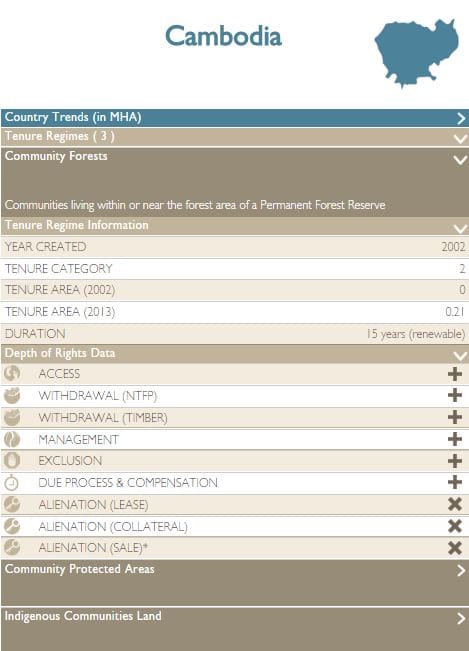
In addition, 27 countries have detailed information about the laws that govern forest land titled to Indigenous Peoples and local communities. The ‘tenure regimes’ data includes how much land these laws cover, what communities they apply to, and whether they guarantee nine rights that determine how these groups can use and manage their forests.

We’re excited to make RRI’s forest tenure data available in a simple, intuitive format. The Forest Tenure Tool joins two other tools that RRI has recently released:
LandMark is the world’s first interactive global platform to provide maps and other critical information on lands that are collectively held and used by indigenous peoples and local communities. The platform provides information at the community and national level that allows users to compare the land tenure situation within and across countries.
Respecting Land and Forest Rights: A Guide for Companies is an online tool that simplifies the process of aligning your company’s operations with the FAO’s Voluntary Guidelines on the Responsible Governance of Tenure. This tool helps corporations and investors mitigate risks in their land and forest operations, and engage host communities to gain a competitive advantage.
